Posts

DEM Interferometri Menggunakan ALOS PALSAR Data

Image
Setelah minggu lalu mencoba interferometri dengan Sentinel 1 dan ESA SNAP, minggu ini saya mencoba kembali percobaan interferometri untuk memperoleh DEM, tetapi menggunakan data ALOS PALSAR dan ENVI SARSCAPE. Percobaan saya lakukan dua kali, pertama menggunakan pasangan data ALOS PALSAR Level 1.1 FBS (Fine Beam Single) SLC, dan percobaan kedua menggunakan ALOS PALSAR Level 1.0 FBD (Fine Beam Double) RAW. Untuk pasangan data pertama selisih temporalnya cukup panjang, hampir 10 bulan, sementara untuk percobaan kedua selisih temporalnya lebih singkat, hanya 46 hari. Tahapan pemrosesan yang dilakukan di Percobaan pertama meliputi: 1. Data Import (Sarscape>Import Data>SAR Spaceborne>ALOS PALSAR) 2. Simulated Orbit Correction menggunakan DEM(Sarscape>General Tools>Orbit Correction>automatic Orbit Correction). DEM yang dipakai adalah SRTM90 3. Interferogram Generation (Sarscape>interferometry>Phase Processing>Interferometry Workflow>Interferogram Generation)...

3D Raster buffering in ArcGIS

Image

DEM Interferometri Menggunakan Sentinel 1 SAR Data (Eksperimen)

Image
Sudah lama sekali saya tidak memperbarui blog ini dengan sebuah tulisan, dan kali ini ada sebuah momen yang saya rasa penting untuk saya tulis. Selain untuk arsip dari apa – apa yang telah saya pelajari, barangkali bisa bermanfaat juga untuk anda pembaca. Tulisan ini bermula dari ketertarikan saya mengikuti kurus penginderaan jauh radar/gelombang mikro yang diadakan oleh ESA (European Space Agency) dalam format online dengan judul ECHOES IN SPACE. Kursus ini gratis dan dapat diikuti siapa saja yang telah memiliki basic pengetahuan penginderaan jauh (cek link INI untuk berpartisipasi). Dari kursus ECHOES IN SPACE, pengetahuan penginderaan jauh system radar/SAR saya jauh meningkat, terutama tentang konsep – konsep teoritisnya, dan hubungannya dengan aplikasi praktisnya. Selama ini memang saya lebih banyak berkutat di penginderaan jauh system optik, dan jarang berkutat di Gelombang Mikro. Meskipun beberapa praktek teknis Radar seperti pembuatan komposit multipolarisasi, geocoding...

How to Clip / Subset Raster Using Graphics in ArcGIS

Image
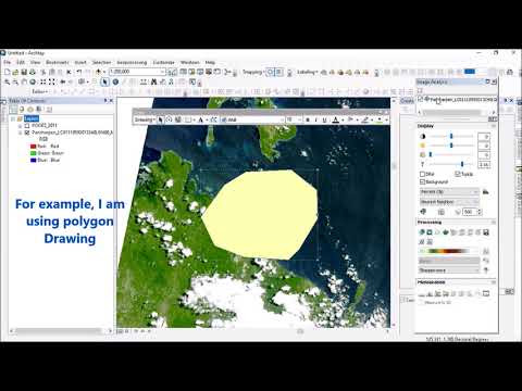
Creating a subset from larger raster datasets is one of the most basic tasks in Remote Sensing Digital Image Analysis. This task usually needs a dataset to be clipped using a certain extent/bounding box or following a defined polygon called Area of Interest (AOI). All Remote Sensing or GIS Software has this capability. The difference is the clipping implementation in some software is smarter and more effective than the others. Compared to other software, Clip or Subset Raster in ArcGIS can be considered as exceptionally well implemented. Raster clipping in ArcGIS could be done in a permanent-result way or temporary way.  The temporary way has more benefit instead of the permanent way. It can deal with huge datasets but not sacrificing processing time. It is super fast. The definition of the clipping area also flexible. You can use ArcMap View as Clipping extent, using loaded polygon shapefiles as AOI, or even graphic layer as the AOI. If you are curious about the latter, I already ...

clean polygon gap sliver multipart and polygon in polygon in ArcGIS

Image

How To Download JERS-1 Satellite Imagery Data From JAXA GPortal

Image

Fill DEM Holes, Voids or Gaps using ArcGIS / Koreksi dan perbaikan DEM di ArcGIS

Image
Gaps, Hole, or Void problems in a DEM could give some pain in the head for GIS users. gaps will cause the derivated data extracted from a DEM to mess up. Hillshade will lose the color grades, contour line will be jagged and causing a huge amount of wrongly generated lines (makes the filesize raised up exponentially too), slope or aspect data are not accurately mapped, and many others.  Gaps could arise due to the limitation of certain DEM extraction methods, or it happens because of the poor handling of DEM mosaicking. Certain DEM extraction methods like photogrammetric DEM extraction, UAV-based DEM, or interferometric DEM are prone to this gap or voids problem. DEM mosaicking from few sources of DEM that have different map projection is also prone to gaps/voids problem.  Fortunately, many GIS and RS software have provided tools dedicated to fix and correct these holes/gaps problem. DEM editing can be done manually using masking approach or pixel-by-pixel editing, or it could ...