Posts

Showing posts from 2015

Portable Basemap Server Tutorials

Image
Since a while ago, I have been creating some tutorials about Portable Basemap Server (PBS), an awesome tools which for some points enabling us to replace few expensive software in the online map services deployment business. For the simplicity purpose, I have been collecting all the created video tutorials into youtube playlist which could you all access thru these embedded playlist below.

Extract ArcGIS REST Map Services Data Using ArcGIS.com

Image
Inspired from a nice tutorial from THIS Blog, I have created a video tutorial how to extract data from ArcGIS Server REST Map Services using ArcGIS.com. Check this out,
Image
Another tutorial, how to convert your ArcGIS MXD into offline maps consumed for Android/IOS Smartphones

Offline ArcGIS Services to be used in Smartphones (PBS Tutorial Series Part 2)

Image
Hey there, another video tutorial incoming, this time it is about how to make offline maps from ArcGIS Map Services, and yes, you could implement the similar procedure to make offline maps from other online map services along it is supported by PBS. here we go

Add Online Basemap Services to ArcMap Using Portable Basemap Server

Image
Just found a nice tutorial about converting online basemap services into ArcGIS ArcMap

GNSS Post Processing Using Trimble RTX (one year free subscription)

Image
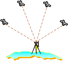
Its been a while since the last time I publish geospatial stuffs in this blog. And today I would like to share some free GNSS services available on the internet and how to fully utilize their services to fulfill your GNSS processing needs, mainly if you needs post processing service and you cant get or you cant reach any software available in the market (though I would like to recommend RTKLIB , a freeware/open source GNSS processing software). Nowadays, doing post processing GNSS measurement data is not only could be achieved using Desktop Software (Trimble pathfinder, Trimble TBC, Leica Geo office, RTKLIB and so on), but also Online Services (Leica Spiderweb, Trimble RTX and may be others). Two main geospatial agencies in my country (Badan Informasi Geospasial/Geospasial Information agency, formerly known as BAKOSURTANAL and Badan Pertanahan Nasional/National Land authority) have developed online GNSS Services using national GNSS Station Network as its core base station data provid

Precise Point Positioning Using RTKLIB,GPS/GNSS Submeter accuracy without Reference Points/Stations

Image
Pada umumnya, ada dua macam cara penentuan posisi menggunakan GPS, yaitu secara absolut atau relatif. Kalau Absolut hanya menggunakan satu receiver (seperti misalnya survei menggunakan gps navigasi), sedangkan relatif menggunakan dua atau lebih receiver (satu receiver diketahui koordinat posisinya, receiver yang lain yang diukur koordinat posisinya) Penentuan posisi secara relatif/Differensial bisa dilakukan secara realtime (RTK/Real Time Kinematic) atau Post Processing (diolah di komputer setelah survei selesai). Masing - masing mempunyai kelebihan dan kekurangan (lihat artikel INI .) Penentuan posisi secara absolut memiliki banyak kelemahan dibanding secara differensial dilihat dari aspek akurasi data yang diperoleh. Dalam penentuan posisi secara absolut, biasanya kesalahan akibat pengaruh atmosfer (bias ionosfer/troposfer) dan efek multipath terhadap sinyal GPS tidak dikoreksi sehingga akurasi datanya sangat rendah (3 meter atau lebih besar tergantung kualitas receiver),

Insert File/Layer Name Into Attribute Table ( The Power Of Phyton Part 5)

Hello,another phyton life saver incominggg the code im going to post below is very useful if you are going to insert the "file name" of your feature classess into attribute table (in certain field of course) Here goes # Import arcpy module import arcpy # Load required toolboxes arcpy.ImportToolbox("Model Functions") # Script arguments Wokspace = arcpy.GetParameterAsText(0) if Wokspace == '#' or not Wokspace: Wokspace = "E:\\Data\\Projects\\NWI\\Test_1" # provide a default value if unspecified Field_Name = arcpy.GetParameterAsText(1) if Field_Name == '#' or not Field_Name: Field_Name = "NAME" # provide a default value if unspecified Field_Type = arcpy.GetParameterAsText(2) if Field_Type == '#' or not Field_Type: Field_Type = "TEXT" # provide a default value if unspecified Field_Length = arcpy.GetParameterAsText(3) if Field_Length == '#' or not Field_Length: Field_Length = "

ALOS GLOBAL DEM 30 Meter Going Free of Charge

Image
Setelah ASTER GDEM dan SRTM, Data DEM (lebih tepatnya DSM) dari satelit ALOS telah direlease secara free of charge oleh JAXA dengan nama ALOS World 3D30 Dataset. Data ini diturunkan dari perekaman stereo satelit ALOS PRISM dengan resolusi 2.5 meter yang menghasilkan DSM dengan resolusi 5 meter. Data ini kemudian di-resample menjadi resolusi 30 meter dan dilepas ke publik secara cuma-cuma. Untuk proses resamplingnya sendiri ada dua metode, yaitu menggunakan filter Average dan filter Median dan kedua hasil resampling diberikan dalam satu paket data download. Biarpun coverage-nya masih belum lengkap (banyak area void/blank yang disebabkan tutupan awan), tampaknya sejauh ini data ini merupakan data topografi paling detil untuk resolusi 30 meter. Secara visual kedetilannya bahkan mengalahkan ASTER GDEM dan SRTM. Contohnya dapat dilihat di gambar di bawah ini dimana saya mengambil contoh tampilan pesisir utara Pulau Bali. Data dapat di download dari situs di bawah ini tapi harus reg
My Geotagged Photos Extracted From FLICKR using loc.alize.us

Renaming (include adding prefix or suffix) tons of feature classes/datasets/rasters/files ( The Power Of Phyton Part 4)

Hello,hey its been a while, today im going to post another phyton codes for your geoprocessing boooring routines. this time I will give short code that is very useful to batch renaming bunch of feature classes in your geodatabases. The code itself just be done few minutes ago when I must renaming tons of feature classes in my current project at office (its about preparing basemap for 50.000 scale Infrastructure map) so lets rideeee # name = batch_renaming.py # Description = rename feature classes in a feature dataset in a fast way # Import System Modules import arcpy from arcpy import env # Set Workspace env.workspace = "E:/Workspace2015/BASEMAP_PII2015/Procdir/SBA Batas_admin_Kabupaten_2013_1/SBA.gdb" # Calling All feature classess list_Fcs = arcpy.ListFeatureClasses() # And Call the Loop Processor for name in list_Fcs:arcpy.Rename_management(name,('batas_kabupaten_'+name)) Explanation : 1. Calling arcpy modules and env (environment), means ArcGIS w

Menambahkan EGM 2008 Geoid file di Software Pathfinder Office untuk digunakan di Trimble GNSS Receiver

Image
POSSIBLE F.A.Q  Mengapa memakai geoid ? ya untuk memperoleh Ketinggian MSL (Mean Sea Level) atau orthometric height yang akurat. Referensi elevasi di GPS adalah Ellipsoidal Height, dikenal dengan istilah HAE (Height above ellipsoid), lihat gambar di bawah ini.  Sebenarnya konsep Mean Sea Level dan Tinggi Orthometrik agak sedikit berbeda, karena Mean sea Level didefinisikan secara relatif, tergantung zona pasut di setiap daerah, sedangkan tinggi orthometrik didefinisikan berdasarkan model gravitasi, tapi untuk kepentingan praktis dianggap sama. Lagipula memodelkan bentuk bumi (geoid) yang sebenarnya sulit dilakukan (jadi tetap saja dipakai pendekatan tertentu, yaitu earth gravitation model).  Emang gede ngaruhnya ? Ya gede, sebagian besar wilayah indonesia selisih elevasi antara MSL dan HAE (height above ellipsoid) datum WGS-84 bisa mencapai 80 meter.  Kan di GNSS atau GPS receiver udah ada pilihan MSL ? Ya, tapi MSL-nya mereferensi kemana ? selama ini kita tinggal

Calculating Volume From A Raster Data, PCI Geomatica style

Image
Menghitung volume dari sebuah data raster (misalnya DEM) biasanya memerlukan beberapa tahapan yang hmm sedikit ribet. Tapi di software PCI Geomatica tidak seperti itu. Dengan kemampuan Spatial Modeler EASI/PACE kalkulasi volume dari data raster dapat dilakukan dengan mudah. Berikut ini saya beri contoh kasus Dirjen Sumberdaya Air Kementerian Pekerjaan Umum dan Perumahan Rakyat akan membangun sebuah bendungan di Trenggalek Jawa Timur dengan nama Bendungan Tugu. Daerah Genangan sudah dipetakan dan Pak Menteri ingin mengetahui volume genangan dari estimasi luasan genangan tersebut. Untuk menjawab pertanyaan dan permasalahan tersebut, Badan Informasi Geospasial telah memberikan sebuah data DEM dari pemrosesan Citra SAR TerraSAR-X dengan resolusi spasial 8 meter. Lets Solve it in software PCI Geomatica!. Saya menggunakan PCI Geomatica versi tahun 2014.  1. Pertama buka Geomatica Focus, dan munculkan layer DEM dan Polygon Genangan (Pastikan menggunakan cartesian coordinate syst

Software Paths.....

Image
1. Freeware / Open Source Remote Sensing Software 2. Commercial Remote Sensing Software 3. Commercial GIS Software 4. Freeware / Open Source GIS Software

Batch Convert MXDs To Previous Version ( The Power Of Phyton Part 3)

Image
A friend just asked me to help her dealing with some ArcGIS 10.2 MXDs while she currently only has access to ArcGIS 10.1, and yes her ArcMap wouldnt open the MXDs. Version differences sure could be real pain in the ass if you are working in multi environment map making. So make sure you are using newest version available in the market (no need to waiting for the crack because "the good guy" ESRI is so kind to give us, literally, 2 months trial, but, actually it is a lifetime trial if you are evil enough to figure out the way). The conversion method is pretty easy and straightforward (even elementary student can do it). But, it will be at different level if you got a bunch of MXDs stored in a bunch of folders, and you need to convert it all. How will you do it? doing it one by one is a disaster man.You will eventually losing precious time while you could use it to go date with some girls out there.  Fortunately, we got phyton which proven to be life saver at difficult

How to open ALOS CEOS Format in ArcGIS 10.x

Image
ALOS adalah satelit penginderaan jauh milik jepang yang diluncurkan tahun 2006 dan berhenti beroperasi pada tahun 2011. Satelit ini membawa tiga sensor pencitraan, yaitu AVNIR-2 (beroperasi pada mode multispektral 4 saluran Blue-Green-Red-NIR dengan resolusi spasial 10 meter), PRISM (beroperasi pada mode pankromatik secara triple stereo dengan resolusi 2.5 meter) dan PALSAR (sensor SAR dual polarisasi). Citra ALOS banyak digunakan di Indonesia selain karena cakupan wilayahnya yang luas harganya juga relatif murah (3-5 juta rupiah per scene). Citra ALOS didistribusikan dalam dua format, geotiff (*.tif) dan CEOS format. Untuk format geotiff kebanyakan software bisa membuka data ini tanpa masalah, namun untuk format CEOS sampai saat ini hanya software pengolahan citra digital penginderaan jauh yang baru bisa membukanya (ENVI, ERDAS, PCI dan mungkin juga yang lain). ESRI Jepang beberapa waktu yang lalu telah merilis sebuah tool dalam bentuk toolbox agar format CEOS dapat dibuka di software